New version 3.0.1 with improved user interface on iPhone
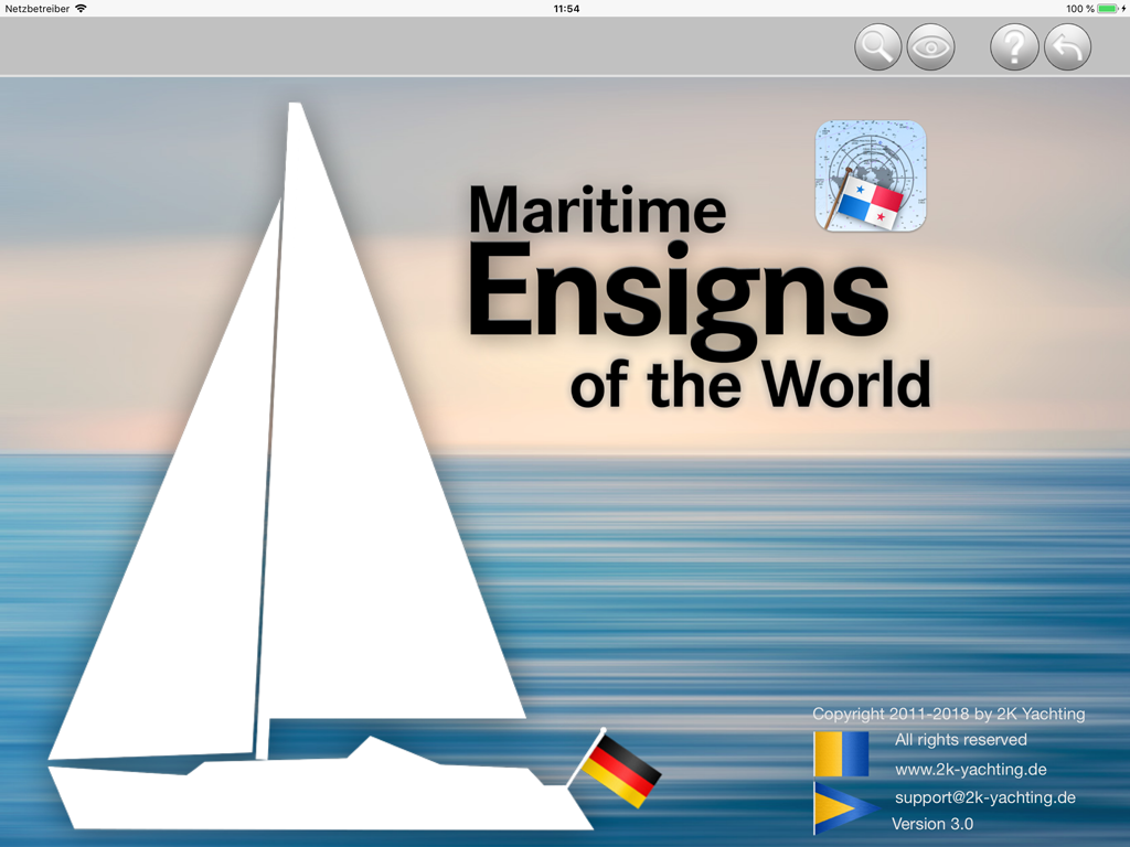
World Ensigns — an app for the iPad und the iPhone
World Ensigns is a visual encyclopedia of naval ensigns. The navigation in World Ensigns is intuitive and nearly language independent. Thanks to the numerous search functions of WorldEnsigns you can easily find flags of ships and their respective countries. WorldEnsigns includes interactive screens for 242 countries or regions and includes a total of 1005 flags with high-resolution details and textures.
In World Ensigns features ensigns of all countries and regions that the ITU (International Telecommunication Union) has assigned a MMSI (Maritime Mobile Service Identity) to.
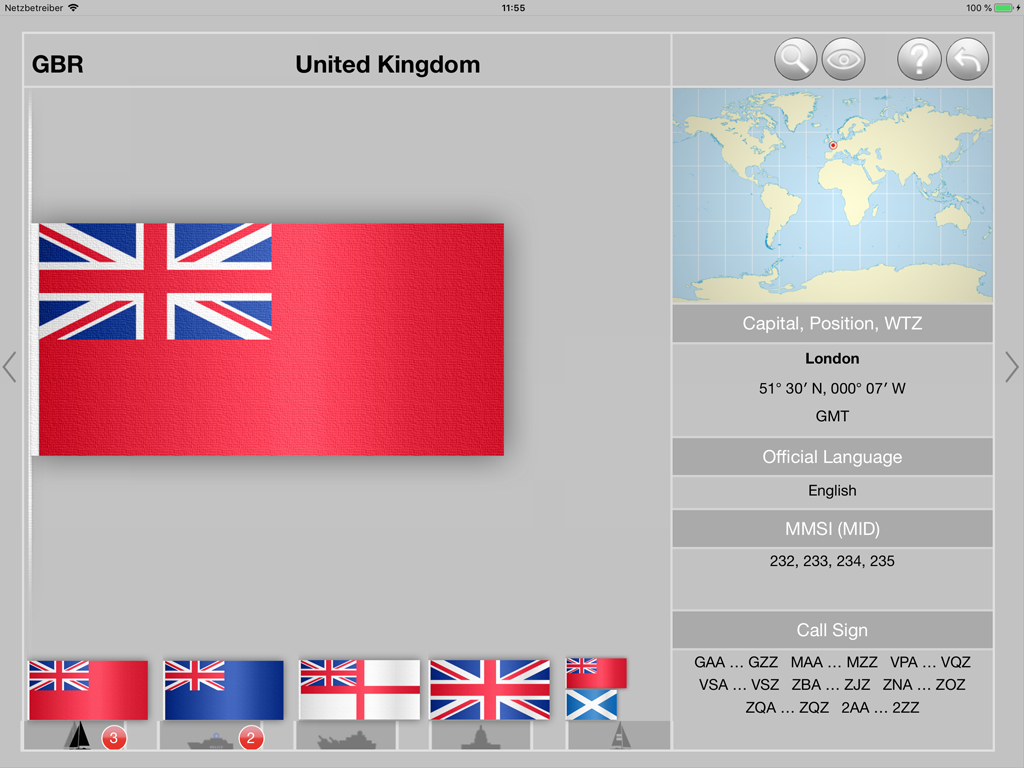
No matter whether you will encounter a ship whose ensign you don't know or whether you see the MMSI or the call sign of a ship with the AIS function of a ship's chart plotter: World Ensigns can quickly show you the ship's country of origin as well as further information about the countries geographic location, timezones and official languages. In addition to the different flags used in this country you will get information about the geographic location of the country, it's timezones and the official languages.
World Ensigns is the ideal compact and mobile reference book for all sailors, motorboaters, people on cruise lines, ship spotters, navigators and everyone with itchy feet: the perfect maritime lifestyle tool.
World Ensigns offers the following features:
Search functions
Information for each ensign
Types of flags
The following screenshots give an insight into the functions of the app
The start screen
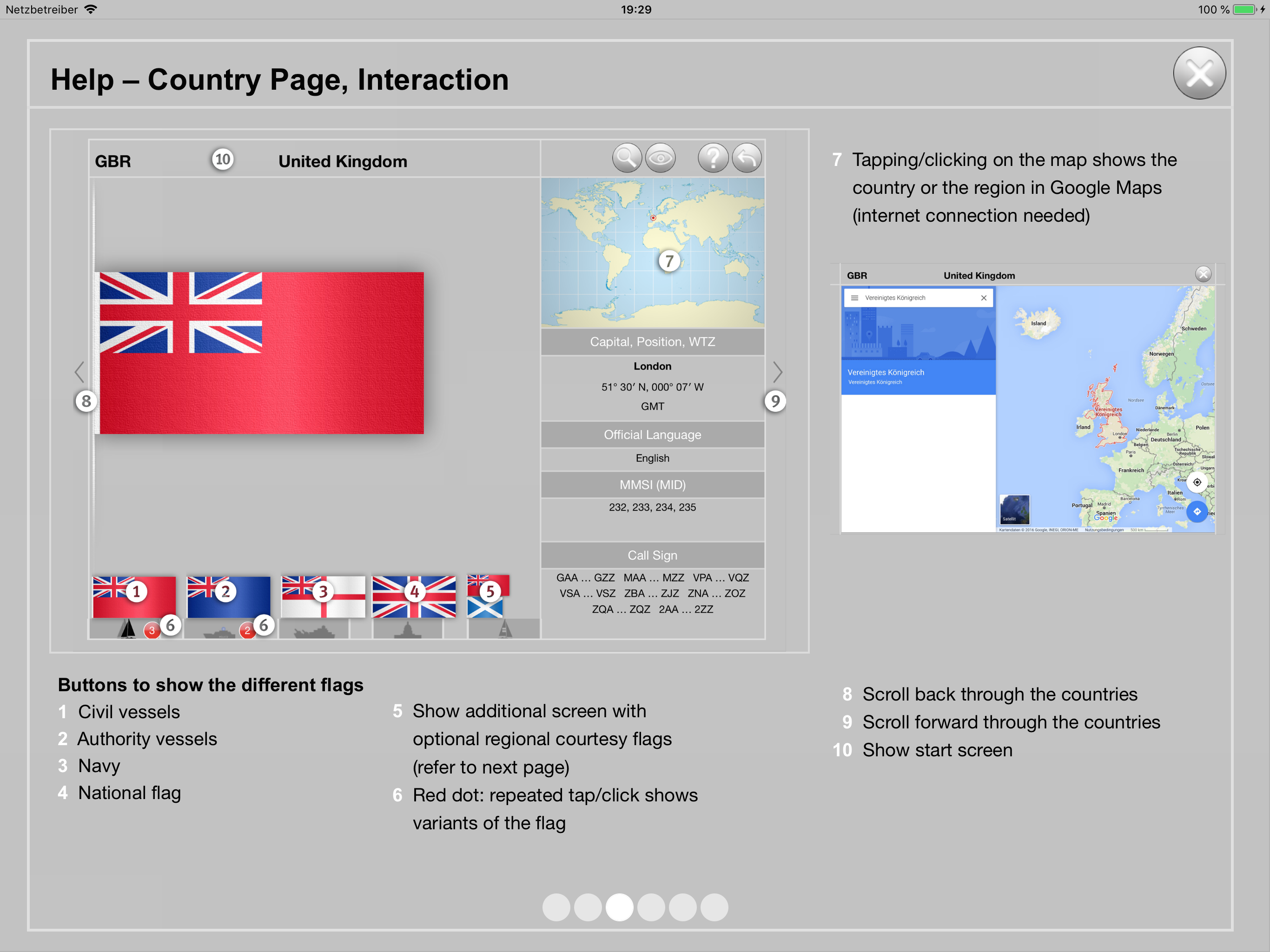
The country page
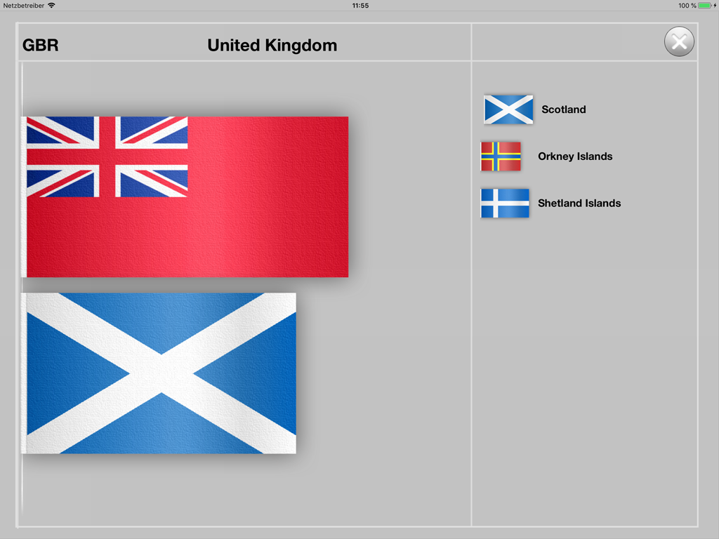
The optional courtesy flags of the country
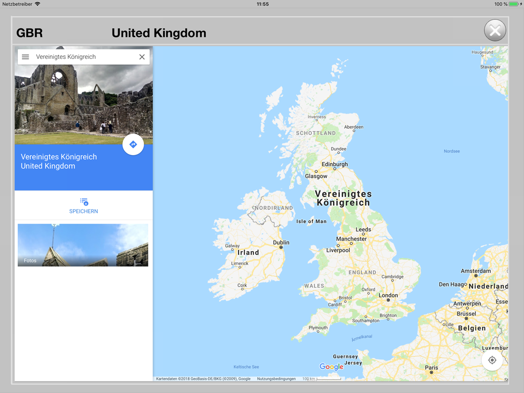
By tapping on the map the country and its capital are shown in Google Maps (internet connection required)
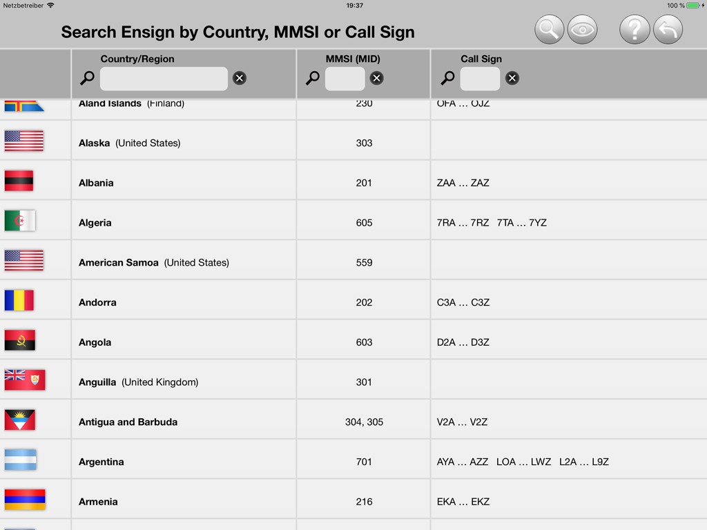
The new, improved search function for searching by country name, MMSI or call sign
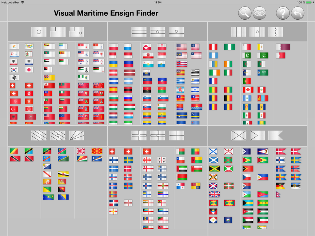
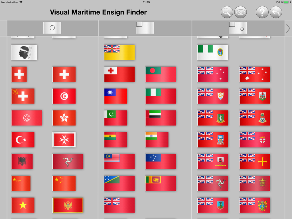
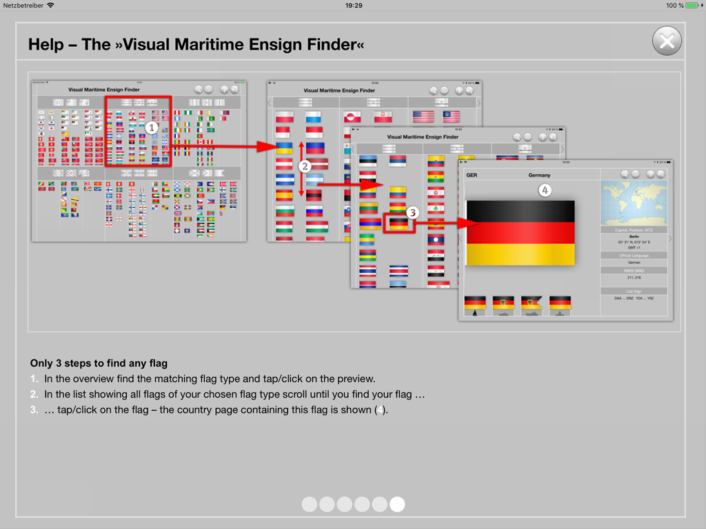
Visual search for geometric and color properties - first in the overview the geometric typed is selected, then you will easily find the flag you are looking for under the flags of the selected type
The integrated help function explains all functions of World Ensigns.
![]()
World Ensigns is available
on the Apple App Store with
optimized screens for iPad and iPhone.
![]()
![]()
You want to have a look at the app first?
Then download our free app
Maritime Ensigns of Europe!
![]()
© 2024 by 2K Yachting